Salt River, Humboldt County, California
|

|
|---|
Geography |
|---|

Ocean going ships once tied up to this pier in Port Kenyon, California. Now, the Salt River channel here is full of sediment and willows.

Closer to the ocean, the tide still enters the Salt River and keeps down the willows. Salt-tolerant rushes line the channel.

Suspended sediment makes the water translucent.

Willows choke the channel and grow right up to the bridge at Dillon Road.
|
The Salt River is a tributary of the Eel River. The mouth of the Eel is at 40 degrees, 38 minutes, 31 seconds North and 124 degrees, 18 minutes, and 48 seconds West on the USGS Cannibal Island Quadrangle, about 15 miles south of Eureka, California. The entire length of the Salt River is contained on Cannibal Island, Ferndale and Fortuna Quadrangles (1:24,000 topographic maps) [USGS ____].
The Eel drains an area of approximately 2.3 million acres (about 930,777 hectares) in Glenn, Lake, Mendocino, Trinity and Humboldt Counties. [USDA 1993]
The Salt River is a remnant channel of a former course of the Eel River. In 1993, it was reported to drain "roughly 10,900 acres [4,411 hectares] on the steep north face of the Wildcat Hills," as well as about 17,500 acres (7,082 hectares) on "the gently sloping to flat flood plain between the base of the Wildcats and the Eel River channel to the north." [USDA 1993]
"Before 1978, when sedimentation had completely blocked the Salt River channel upstream of Williams Creek, [the] Salt River drained an additional 1,400 acres [567 hectares] of upland east of Williams Creek, including the Coffee Creek drainage. Runoff from drainages east of Williams Creek is presently diverted into Perry Slough and the `old river' channel, and into the Eel River upstream of the estuary." [USDA 1993]
"Presently, five named tributaries head in the Wildcats and drain into the Salt River channel." The creeks are named Williams, Francis, Reas, Smith and Russ. In 1993, Williams Creek had the greatest drainage, followed by Russ, Francis, Reas and Smith Creeks. [USDA 1993]
| Tributaries of the Salt River |
|---|
| Tributary Name
| Upper Watershed Drainage
acres
| Distance of Tributary
Mouth to the Eel
miles
|
|---|
| Russ Creek | 2,080
| 0.8 |
| Smith Creek | 160
| 2.1 |
| Reas Creek | 1,210
| 3.2 |
| Francis Creek | 1,990
| 4.9 |
| Williams Creek | 3,660
| 7.4 |
Table data source: USDA 1993
A traveler to the region in 1888 reported that the area around Ferndale had been mostly deforested "the timber remaining only in bunches." The land had been divided into forty-acre farms. Levees were constructed to drain the tidal marshes and the delta grew potatoes and produced dairy products. "By the early 1900's, three developments contributed to the end of shipping in the area:
- potato blight and falling prices made growing and shipping of potatoes uneconomical; and some of the cropland was converted to pasture;
- the Northwestern Pacific Railroad and the Redwood Highway were completed; and
- the Salt River filled with sediment to the extent that the channel became too shallow to allow for passage." [USDA 1993]
Dairying and ranching continue along with some sheep, goats and other livestock. Some row crops are grown, but the massive production of potatoes which so characterized the valley in the late 1880's moved uphill to the Klamath and Idaho.
The "Eel River Resource Conservation District (RCD) was formed by popular vote in March 1987, with the primary purpose of addressing resource problems associated with sedimentation and flooding along the Salt River." [USDA 1993]
|
Tides |
|---|
"Tidal influence in the Salt River extends to Port Kenyon, approximately four miles" (approximately 6.4 kilometers) upstream. [USDA 1993]
"Local tides are mixed diurnal, meaning that the two high waters and low waters of each tidal day are unequal. Tidal influence in the Eel River generally extends upriver to Fernbridge, where zero point on the flood gauge is 4.1 feet above mean sea level." [USDA 1993]
|

Live Moon Phase
| Online Resources
|
Flooding |
|---|

Ducks swim in a flooded field on this dairy farm.
|

Daily plot of the Eel River stage.
|
|---|

20 day plot of the Eel River at Fernbridge.
|

Some roads stay flooded in March.
|

| Driving on the river bar at Fernbridge is popular. The entry next to the bridge is not for the faint at heart. Stay on the trails and don't hot dog in the loose sediment! |

|
|---|
Geology |
|---|
Burdette Ogle wrote Geology of the Eel River Valley Area, Humboldt County, California in 1953. On pages 71 to 73, he wrote:
The late history of the Eel River involves a progressive moving of the channel from the northern edge of its valley, north of Metropolitan, to its present course between Metropolitan and the mouth of the Van Duzen River. A series of low terraces made up of pebbles, sand and capped with silt, were formed. Numerous irregular old channels have been preserved...
From the confluence of the ancient Eel and Van Duzen Rivers, the combined rivers' course was westward along the line formed by the present abrupt slope bordering the south edge of the Eel River Valley. This sharp line was cut since deposition of the Rohnerville terrace... [since then] by progressive meanders and braiding, swung north and west to Fernbridge. From there it shows considerable meandering and some braiding in its lower course. The record of the meandering, northeastward progression is shown by successive, low noncyclic terrace levels, and the preservation of old channels.
At some moderately recent time the Eel swung northeast out of its channel cutting off the Salt River's most important water source. At the present time flood waters from the Eel occasionally may flow through the channel, but the rest of its water source is from such streams as Williams Creek and Francis Creek. Near its mouth, the Salt River receives tidal water and is brackish.
In its lower course, the channel of the Eel shifts annually in sweeping meanders causing considerable property redistribution. The sloughs, drowned channels, tidal incursion, and spits indicate a local subsidence of the coast. The Eel drainage is drowned at the mouth. Man-made dikes and levees now protect much of the land and affect the course of the river and its normal sedimentation. U.S. Coast and Geodetic Survey Chart 5602 (1940) shows no evidence of delta formation offshore; instead, the strong, along-shore currents build spits across the mouth of the Eel Bays and Humboldt Bay.
The lower Eel River follows generally the trough of the Eel River syncline... As gentle warping began, the Ferndale Hills and coastal area were raised and tilted northward. Rotational elevation has continued to the present, raising the wave-cut terrace (S26,T2W,R4W,H) to an elevation of 950 feet while the Hookton formation at Centerville Beach passes below sea level...
From the distribution pattern, lithologic character, and limited fossil evidence it is probable that the ancestral Van Duzen-Eel River system may have flowed northward during Hookton deposition. This drainage may have emptied into a large ancestral bay extending far north and south of the present one. As warping... began, the great southern streams were blocked off by the development of Table Bluff and the new bay area was delimited. [pages 71-73]
For more information on local geology, see my
Humboldt Geology for fossil hunters.
|
Historical Changes |
|---|
In the Salt River Watershed Review Report, writers from the U.S. Soil Conservation Service wrote on the historical background of changes to the Eel and Salt River courses from 1800 to 1987:
The following discussion is based on testimony made at a 1937 public hearing on erosion and flooding problems on the Eel River, the book Along the Banks of the Salt River by Denis P. Edeline (1983), field observations and current knowledge of river mechanics.
In 1800, the Eel River was probably one quarter to one half mile wide from bank to bank at its widest point from the vicinity of Fernbridge to the Pacific Ocean. It is assumed this was also true from Fernbridge upstream to the Eel-Van Duzen River's confluence. The active channel was 500 to 600 feet wide in many places and water depths at Fernbridge were 25 to 30 feet. Ten foot tides in summertime from Fernbridge were the norm. The channel was essentially straight from Fernbridge to the ocean. The channel banks, channel bottom between the banks, and the active channel were covered with trees and brush.
This early channel moved its gravel-sized sediment load all the way to the ocean. Floods involved overbank flow of low velocity that were silt and clay loam. Early settlers (1850) built homes on the floodplain and cleared the land of trees so they could farm. The Salt River was probably a flood outlet for the Eel River which lessened the degree of flooding downstream of the Eel-Van Duzen confluence. The Salt River was deep enough to allow ocean-going steamships to move up to Port Kenyon until around 1895. From Port Kenyon to the ocean, the Salt River was over 20 feet deep and at least 100 feet wide. Riparian vegetation lined the banks but the channel was open.
Sometime around 1890-1900, the Eel River sediment load and discharge began increasing, probably due to upper watershed timber harvesting. During this time, the river's floodplain was being cleared of trees and brush for farming. As gravels moved from the steep upper watershed down to the flat Eel River delta, deposition occurred. These gravel bars were massive and the river flows would often deflect around the bars and hit the river banks. Settlers had cleared the banks of trees so the weakened, alluvial sediments offered little resistance to the flows. The Eel River began widening and meandering. The initial buildup of the Eel River bottom probably increased flooding, so the Salt River probably received more frequent floods after 1900 than it had in the past. The Salt River probably began to silt in near its mouth at this time due to the tides retarding the runoff.
Click here to read about the
effects of the 1906 earthquake on Ferndale, the Eel River Valley, Petrolia and surrounding areas from the April 20, 1906 Ferndale Enterprise
|
Logging and grazing in the upper watersheds of Salt River accelerated erosion and runoff after 1900. The decrease in grade or capacity in the Salt River due to sediment deposition near its mouth caused the runoff and sediment from the upper watershed to add to flooding and sedimentation problems along the creeks and Salt River.
By 1937, some of the banks of the Eel River had moved 2 miles from their pre-1900 positions. The river widened to more than a mile in places and three great river bends formed between Fernbridge and the ocean. Some of the gravel bars grew almost as high as the banks of the river. The decreased cover in the upper watershed produced more runoff and sediment and people living along the Eel River suffered floods in 1906, 1926, 1927, 1928, twice in 1936, and twice in 1937.
|
Pontoon Bridge
In a few days there will be placed in position at the Salt River crossing, near Arlynda at the Dungan ferry road, a pontoon bridge for the convenience of light rigs. The suspension bridge at that place is still unsafe for travel.
Geo Hindley
Supervisor 1st District
January 12, 1906
Ferndale Enterprise |
|
Landowners along the Eel River in 1937 were more concerned with river bank erosion than with the flooding. They and the U.S. Army Corps of Engineers estimated about 100 acres of farmland was being lost each year to bank erosion from 1900 to 1937.
The large floods on the Eel River have impacted the Salt River landowners also. They may have associated all their flooding and sedimentation problems to the Eel River. Significant factors that had influenced these flooding and sedimentation problems were caused by the tributaries of Salt River, namely Coffee Creek, Williams Creek, Francis Creek, Reas Creek and Smith Creek on the south side of the Salt River Watershed.
Another major logging period occurred from 1940 to 1960 to meet the demand for new housing following World War II. This logging was done with machinery that tended to disturb the watershed cover to a greater degree than during the days of horse logging. Additional water and sediment were delivered to the Eel River causing more bank cutting and flooding.
Current residents are suffering the consequences of watershed mismangement of past decades. There are still massive gravel bars in the Eel River that are almost as high as the adjacent river banks. Bank cutting will continue to occur until the Eel River has established a channel geometry in step with the fluvial regime of its watershed.
Salt River landowners also appear to be suffering the consequences of the major timber harvesting in the 1940's and 1950's in the upper watershed. In addition, extensive grazing has futher accelerated erosion and concentrated runoff from the upper watershed. Sedimentation has almost completely filled in the Salt River from Ferndale downstream. The lack of channel capacity due to sedimentation, encroachment of riparian vegetation and tides cause flooding along the Salt River and also cause flooding adjacent to the creeks entering the River because there is no place for the water to drain away. [pages 1 to 3]
|
References and Resources
|
|---|
Literature Cited
-
[Ogle 1953] Ogle, Burdette A. 1953. Geology of Eel River Valley Area, Humboldt County, California. State of California Department of Natural Resources, Division of Mines. Bulletin 164, November 1953. 128 pages. Six plates.
-
[USDA 1993] USDA Soil Conservation Service. 1993. Salt River Watershed: Local Implementation Plan, Humboldt County, California. Water Resources Planning. Davis and Eureka Offices, California. March, 1993. Unpublished. 82 pages + i-v and 2 unpaginated. Followed by appendixes. A Water Quality (under "separate cover" not examined for this paper), B Fishes and Invertebrates..., C Testimony... October 12, 1979 (historical picture of the Eel River Fishery), D Facts sheets and design drawings.
-
[USDA 1987] USDA Soil Conservation Service. 1987. Salt River Watershed Review Report. In cooperation with the Eel River Resource Conservation District, November 1987. Unpublished. Nine pages looseleaf.
-
[USGS_____] US Geological Survey. Cannibal Island, Ferndale and Fortuna Quadrangles 1:24,000 topographic maps.
Literature review of the Salt River lists papers by topic and spans two centuries.
Geological Illustrations
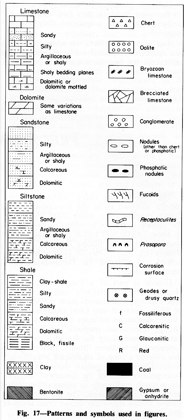
Standard rock symbols .
Complete Geologic Column
Off-site reference materials.
- Printout a topographic map that shows the Salt River, the mouth of the Eel River, Ferndale and Centerville. Go to
Topozone.com
and enter "Ferndale, California" in the search box. Click on it when it asks you to confirm. Then center your cursor on 40 degrees, 36 minutes, 10 seconds North and 124 degrees, 16 minutes and 5 seconds West, set the view scale
to 1:250,000 on their 1:24K/25K USGS Topo Map Series.
Acknowledgements
Field trip participants: Ken Mierzwa, Lisa Samuels, Brittany, Selena, Brandon and Kenneth Ybarra, and Ellin Beltz. All photographs courtesy of Ken Mierzwa, copyright 2004 and all rights reserved.
|